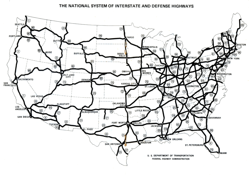
The map above shows the Interstate Highway System as it was in 1970. Work on the
highway project began in the 1950s. It made the cost of long distance travel much
less expensive, and cut driving time on long trips dramatically.

| The Interstate
Highway System Fasttrack to America's Past |
|


|
Copyright Notice
Copyright 2020 by David Burns. All rights reserved. |